
From 2.450 €
5 (3 Reviews)
11 Dates
I have some questions 🙋The Haute Route glacier trek from Chamonix to Zermatt is one of the great alpine journeys in the world. Over seven days, you’ll traverse approximately 71 kilometres of high-mountain terrain, cross eight glaciers, climb four passes above 3,000 metres, and sleep in five of the most spectacularly positioned mountain huts in the Alps — linking Mont Blanc to the Matterhorn on a single, continuous journey through the heart of the Pennine Alps.
This is the glacier version of the Haute Route: not a hiking trail, but a high-altitude traverse through remote, glaciated terrain. You’ll rope up each morning, put on crampons, and move through a landscape of ice, rock, and silence that most people only ever see in photographs. It is more demanding and more rewarding than the traditional walkers’ route, and it remains one of the finest mountain experiences available anywhere in the Alps.
This is one of the most important things we can tell you about this program: you do not need prior experience with crampons, ice axes, or glacier travel to join the Haute Route glacier trek with SummitGuides.
Day 1 is deliberately short — a 3.5-kilometre approach to the Albert 1er Hut — specifically to leave the entire afternoon free for a dedicated glacier training session on the Tour Glacier. Your UIAGM/IFMGA Mountain Guide will teach you everything you need: how to walk in crampons, how to use an ice axe for balance and self-arrest, and how to move safely as a roped team on glaciated terrain.
This is hands-on, practical instruction in a real glacier environment — not a classroom exercise. By the end of the session, you’ll have practised the techniques you’ll use for the rest of the week. And from Day 2 onwards, your guide is right there on the rope with you, reinforcing skills and managing safety at every step.
What we do require is solid mountain hiking experience, good cardiovascular fitness, and the ability to walk 6–8 hours per day on consecutive days while carrying a pack of approximately 8 kg. The guide handles the technical decisions; your preparation handles the physical ones.
This approach makes the Haute Route accessible to a much wider range of experienced trekkers — hikers who have walked multi-day routes in the Alps, who are fit and motivated, but who have never had the opportunity to travel on glaciers. We believe this is one of the great alpine experiences, and it shouldn’t be limited only to those who already have mountaineering backgrounds.
The Haute Route glacier trek covers a total elevation gain of over 4,000 metres across seven trekking days. Each day brings a different character: from the glacier training and first hut night on the Tour Glacier, to the vast silence of the Otemma Glacier, to the exposed ladders of the Bertol Hut, to the panoramic climax of Tête Blanche at 3,710 metres — the highest point of the entire Haute Route.
The route begins in Chamonix, at the foot of Mont Blanc in France, and ends in Zermatt, beneath the Matterhorn in Switzerland. Between these two iconic mountain towns lies some of the most dramatic high-alpine terrain in Europe: a succession of glaciers, moraines, rocky passes, and remote valleys that have been the domain of mountaineers since British climbers and Swiss guides first completed the traverse in 1861.
This is not a technical climb. You don’t need to be a mountaineer. But you do need to be fit, comfortable with sustained effort, and prepared to learn. The terrain involves roped glacier travel, walking in crampons on ice and snow, and on one stage, climbing metal ladders fixed into a rock face to reach the Bertol Hut. Your UIAGM/IFMGA Mountain Guide manages the technical aspects — the rope work, the route finding, the safety decisions — while you focus on the walking and the experience.
Daily stages range from 3.5 to 13.4 kilometres, with walking times of 3 to 8 hours depending on the day. The itinerary is deliberately paced: shorter days at the beginning to build skills and acclimatize, a recovery day before the sustained glacier block, and a gentle final descent into Zermatt.
Our Haute Route itinerary is built on more than 20 years of guiding experience on this route. Every detail — the hut sequence, the daily distances, the altitude profile, the placement of the rest day — reflects what we’ve learned from completing this traverse year after year in varying conditions.
The 7-day format includes a night at the Schönbiel Hut, which many operators skip. This means the final day is a relaxed 3-hour descent into Zermatt through alpine meadows with the Matterhorn directly ahead — not a gruelling forced march after an already demanding week. It also means you spend an evening directly beneath the Matterhorn’s north face, one of the most powerful settings on the entire route.
The acclimatization profile is carefully managed. You sleep at 2,702 m on Night 1, drop to 1,500 m on Night 2 (the Champex valley night), then build progressively through 2,461 m, 3,160 m, and 3,311 m before descending to 2,694 m for the final night. The valley night after reaching 3,289 m on the Col Supérieur du Tour is a textbook “climb high, sleep low” strategy that prepares your body for the sustained high-altitude days that follow.
Day 3 — the transfer from Champex to the Chanrion Hut — is deliberately the easiest stage of the entire trek. It comes immediately before three consecutive glacier days (Days 4, 5, and 6), giving you a full recovery day when you need it most. This isn’t filler; it’s strategic design that increases your chances of completing the full traverse feeling strong rather than depleted.
The Haute Route glacier trek crosses eight major glaciers between Chamonix and Zermatt: the Tour Glacier, the Trient Glacier, the Otemma Glacier, the Mont Collon Glacier, the Upper Arolla Glacier, the Mont Miné Glacier, the Stockji Glacier, and the Zmutt Glacier. Each has its own character — from the compact training ground of the Tour Glacier to the vast, meditative expanse of the Otemma, to the crevassed descent of the Stockji beneath the Matterhorn.
Four high passes structure the route: the Col Supérieur du Tour (3,289 m), which crosses from France into Switzerland on Day 2; the Col de Charmotane (3,015 m), the gateway to the Vignettes Hut; the Col de l’Evêque (3,392 m), the most technically demanding crossing; and the Tête Blanche (3,710 m), where the panorama of Valais 4,000-metre peaks — Matterhorn, Dent Blanche, Dent d’Hérens, Weisshorn — is one of the most celebrated viewpoints in the Alps.
Nights on the Haute Route are spent in high-mountain huts — a defining part of the experience. These are not hotels. They are remote refuges perched on ridges and rocky spurs, accessible only on foot, where climbers and trekkers share communal meals, dormitory sleeping, and sunsets over glaciers.
The Albert 1er Hut (2,702 m) sits above the Tour Glacier with views of the granite spires of the Aiguille du Chardonnet. The Chanrion Hut (2,461 m) occupies a quiet, remote position at the head of the Val de Bagnes. The Vignettes Hut (3,160 m) is perched on a rocky spur above a sea of glaciers, with one of the most dramatic terraces in the Alps. The Bertol Hut (3,311 m) — accessed by climbing ladders up a steep rock tower — is a true eagle’s nest, offering 360-degree views over the high peaks. And the Schönbiel Hut (2,694 m) sits directly beneath the Matterhorn’s enormous north face, providing the final night’s accommodation in a setting that is difficult to forget.
One night is spent in Champex (1,500 m), a quiet Swiss lakeside village where a guesthouse offers a hot shower, a comfortable bed, and a change of rhythm after two days in the mountains. This valley night is not an accident — it’s a deliberate acclimatization strategy, allowing your body to recover at lower altitude before the sustained high-altitude block that follows.
Hut meals are hearty and generous: typically a soup or starter, a main course, and dessert. Vegetarian options and alternatives for common intolerances are available at most huts. Water must be purchased at the huts. Sleeping is in dormitory rooms with blankets provided — you bring a sleeping bag liner.
We’ve been guiding the Haute Route for over 20 years. Our guides know this route intimately — every glacier, every pass, every hut warden by name. That familiarity translates into better decisions on the mountain: the right pace for the conditions, the best route through crevassed terrain, the knowledge of when to push and when to wait.
Safety through expertise. Every SummitGuides trip is led by UIAGM/IFMGA certified Mountain Guides — the highest international standard of mountain guiding qualification. Our guides carry all necessary safety equipment and have extensive experience managing glacier terrain, weather changes, and altitude challenges.
Accessibility without compromise. We welcome trekkers who have never been on a glacier before. Day 1 includes a complete training session that gives you all the skills you need. This makes the Haute Route accessible to a wider range of experienced hikers — not just those with prior mountaineering backgrounds — without reducing the quality or safety of the experience.
A thoughtfully designed itinerary. The pacing, the hut sequence, the acclimatization profile — every detail of this program reflects what we’ve learned from years of guiding the Haute Route. The easy Day 3 before the glacier block. The valley night in Champex for altitude recovery. The 7-day format that includes the Schönbiel Hut, allowing a shorter final day and a proper farewell to the mountains beneath the Matterhorn. Nothing is accidental.


The day before the program starts, at 6 PM, meeting in Chamonix with the guide. Your guide will introduce themselves, review your gear, and go over the plan for the coming week along with the latest weather forecast.
This is also the moment to address any questions about glacier travel. If you’ve never worn crampons before, your guide will reassure you: tomorrow’s training session is designed precisely for this, and by the end of Day 1 you’ll have all the skills you need.
Please make sure to attend the meeting with your gear (technical gear and clothing), so the guide can conduct a proper equipment check and ensure you’re well prepared for the week ahead.
We transfer from Chamonix to the village of Le Tour (1,450 m) and take the lifts up toward the Col de Balme area (2,100 m). From here, a comfortable trail crosses alpine terrain and moraine to reach the Albert 1er Hut, perched at 2,702 metres with commanding views over the Tour Glacier and the granite spires above.
After settling in and a well-deserved break, we head out onto the Tour Glacier for the afternoon’s training session. Your guide will teach you how to walk in crampons, how to use an ice axe, and how to move as a roped team on glacier terrain. This is a hands-on, practical session — by the end of it, you’ll feel confident and prepared for the glacier crossings ahead.
We return to the hut for dinner. The Albert 1er is a classic high-mountain refuge: communal dining, hearty food, and a sunset over the glacier that sets the tone for the entire week.
Ascent: +600 m | Distance: 3.5 km | Walking time: approx. 2.5–3 hours + training session
Early start. We rope up and step onto the Tour Glacier — the first real glacier day, putting yesterday’s training to immediate use. The ascent is steady and absorbing, with the scale of the glacial landscape opening up around us as we climb.
The Col Supérieur du Tour (3,289 m) is the first major high pass of the Haute Route and the crossing point from France into Switzerland. The views from the col are superb: Mont Blanc behind us, the Swiss Alps ahead, and the vast Trient Glacier unfolding below. It’s a powerful moment — the journey has truly begun.
We descend the Trient Glacier into Swiss territory, then follow a beautiful balcony trail with long views across the Rhône valley. The La Breya chairlift brings us down to Champex (1,500 m), a quiet lakeside village where we spend the night in a guesthouse.
After two days in the mountains, Champex offers a welcome contrast: a hot shower, a comfortable bed, and a proper Swiss dinner. It’s also excellent for acclimatization — sleeping at 1,500 metres after reaching 3,289 metres is a textbook “climb high, sleep low” profile, preparing your body for the high-altitude days ahead.
Ascent: +715 m | Descent: −1,200 m | Distance: 10.9 km | Walking time: approx. 6–7 hours
A gentler day — deliberately placed before the three big glacier stages that follow. We transfer by taxi from Champex to the Mauvoisin Dam (1,975 m), a dramatic concrete wall holding back the turquoise waters of the reservoir deep in the Val de Bagnes.
The trek follows a long, scenic traverse above the lake. The Tournelon Blanc (3,700 m) and the peaks of the Grand Combin massif (4,313 m) rise across the valley, and the trail moves through alpine pastures where marmots whistle from the boulders and, in early summer, wildflowers cover the hillsides.
Your guide may tell you the story of the Giétro catastrophe of 1818, when an ice dam collapsed in this valley and devastated the communities below — a vivid piece of local history that connects you to the landscape in a deeper way.
We reach the Chanrion Hut (2,461 m) in the early afternoon. It’s a welcoming refuge in a remote setting, and the moderate effort of the day leaves energy for rest and conversation. The guide will brief the group on what’s coming next: three consecutive days on the high glaciers, the most demanding and most spectacular section of the Haute Route.
Ascent: +485 m | Distance: 8.5 km | Walking time: approx. 3.5–4 hours
Today we enter the high glacier world, and we won’t leave it for three days.
From the Chanrion Hut, we make our way into the Otemma Glacier basin — one of the largest glacier systems in the Valais. The scale is striking. For more than 8 kilometres, we travel across the glacier in a vast, silent landscape of ice and distant peaks. The ascent is gentle but sustained, and the rhythm of roped travel becomes meditative: step by step, the sound of crampons on ice, the immensity of the terrain absorbing everything around you.
At the Col de Charmotane (3,015 m), the route turns and the Vignettes Hut appears ahead, perched on a rocky spur high above the surrounding glaciers. It looks impossibly steep from below, but the final ascent is manageable, and the reward is one of the finest hut positions in the Alps.
The Vignettes Hut (3,160 m) is your first night above 3,000 metres. The panorama from the terrace is extraordinary — a sea of glaciers and rocky ridges extending in every direction. Your guide will be monitoring how the group responds to the altitude, and the acclimatization work of the previous days pays off here.
Ascent: +770 m | Descent: −80 m | Distance: 12.5 km | Walking time: approx. 6–7 hours
This might be the most technically varied day of the entire route. You'll cross two significant cols, descend and ascend glaciers, and finish by climbing ladders to reach what's arguably the most dramatically positioned hut in the Alps. It's demanding but spectacular, and by now your glacier skills are solid enough that you can actually enjoy the terrain rather than just surviving it.
The day begins with a short descent to the Glacier d'Arolla, then a steady climb to Col de l'Evêque (3,392m). The views from the top are immense: you can see back over the route you've traveled and forward to the Matterhorn region.
The descent from l'Evêque onto the Haut Glacier d'Arolla is where the day gets interesting. The upper glacier is steep enough to require careful foot placement, and in late summer there can be sections of exposed ice where crampons really earn their keep.
At the base of the glacier, you reach Plan de Bertol, a flat area with a shepherd's hut where most groups take a break. From here you can see Cabane de Bertol perched on its rock pinnacle, accessed by a series of ladders fixed to the rock face. The final 250 meters of elevation gain are unlike anything else on the route, you're climbing metal ladders, stepping from one to the next, with serious air beneath you. It's exposed, thrilling, and utterly safe (thousands of people use these ladders every season), but it definitely gets your attention.
Bertol Hut sits atop its rocky perch like an eagle's nest, surrounded on all sides by glaciers and peaks. The Dent Blanche dominates the western view, the Matterhorn is visible to the east, and you're genuinely perched in the middle of nowhere. The hut itself is charming: old-school mountain refuge atmosphere, welcoming guardians, and an evening light show on the surrounding peaks that makes you understand why people become mountain addicts. This is the night many people realize they'll be back, the mountains have gotten under their skin.
Ascent: +950 m | Descent: −1,050 m | Distance: 13.4 km | Walking time: approx. 7–8 hours
The scenic climax of the Haute Route.
We begin by descending the same ladders we climbed yesterday — a sharp wake-up that quickly focuses the mind. From the base of the ridge, we rope up and cross the wide plateau of the Mont Miné Glacier, with the Tête Blanche ahead.
The ascent to Tête Blanche (3,710 m) is the highest point of the entire Haute Route, and the panorama from the top is staggering. The Matterhorn, the Dent Blanche, the Dent d’Hérens, the Weisshorn — dozens of 4,000-metre peaks fill the horizon in every direction. This is the moment everything has been building toward. Your guide will give you time here. There is no rush.
From Tête Blanche, we begin the long descent of the Stockji Glacier, winding through a spectacular landscape of crevasses and seracs. The scale and beauty of this descent make it one of the most memorable glacier passages in the Alps.
We cross the moraine of the Zmutt Glacier and make a short re-ascent to the Schönbiel Hut (2,694 m), our final mountain hut. The Matterhorn’s north face rises directly above — enormous, dark, and close enough to feel its presence. This is the setting for your last evening in the high mountains, and it doesn’t disappoint.
Ascent: +565 m | Descent: −1,100 m | Distance: 11.7 km | Walking time: approx. 6–7 hours
No early alarm this morning. A relaxed breakfast, a final look at the Matterhorn from the hut terrace, and we begin the descent.
The trail winds through alpine meadows, wildflower pastures, and scattered larch forest — a beautiful contrast to the glacial world we’ve been immersed in for the past six days. Throughout the descent, the Matterhorn’s north face is directly ahead, growing steadily as Zermatt draws closer. It’s a view that accompanies every step and makes this final morning feel like a slow, satisfying conclusion.
We arrive in Zermatt by late morning. The journey from Mont Blanc to the Matterhorn — seven days of glacier travel, five mountain huts, eight glaciers, four high passes — is complete.
Celebration in Zermatt. Return to Chamonix by private minibus in the early afternoon.
Descent: −1,086 m | Distance: 10.3 km | Walking time: approx. 3–3.5 hours
The Haute Route glacier trek is a demanding high-alpine journey that requires good fitness and mountain hiking experience. You do not need previous glacier or crampon experience — Day 1 includes a full training session — but you should be physically prepared for sustained effort at altitude.
Cardiovascular fitness. You should be comfortable hiking for 6–8 hours per day on consecutive days, with elevation gains of up to 1,000 metres in a single stage.
Mountain hiking experience. You should have experience walking in mountainous terrain and be comfortable on steep, uneven ground.
Pack carrying ability. Your rucksack should not exceed 8 kg. You will carry all personal equipment throughout the trek.
Mental readiness for hut life. Accommodation is in mountain huts with dormitory-style sleeping, communal meals, and early morning starts. Comfort is basic but the atmosphere is warm and the food is hearty.
No previous glacier experience required. Your UIAGM/IFMGA guide will teach you crampon technique, roped glacier travel, and basic ice axe use during the training session on Day 1. By the end of the afternoon, you will have the skills needed for the glacier crossings ahead.
We recommend preparing with regular endurance training in the months before the trek: hiking with a loaded pack, running, cycling, or any sustained cardio activity. Core strength exercises are also valuable.
If you’re unsure whether your fitness level is sufficient, please reach out to us. We’re happy to discuss your experience and help you assess your readiness.
No. Day 1 of the program includes a dedicated glacier training session on the Tour Glacier, where your guide will teach you how to use crampons, walk on ice, handle an ice axe, and travel as a roped team. The training is hands-on and practical. By the end of the session, you’ll have all the skills needed for the glacier crossings ahead. What we do require is solid mountain hiking experience and a good fitness level.
The season runs from late June to mid September, when glacier conditions are stable and the huts are open. Early summer (late June to mid-July) tends to offer snowier conditions on the glaciers, while August and early September bring warmer days and more exposed ice. Each period has its own character, and the guide adapts the approach to current conditions.
Lunch is not included. We recommend bringing easily digestible, high-energy food: cereal bars, dried fruit, nuts, chocolate. On Day 3, during the transfer from Champex to the Mauvoisin Dam, there may be an opportunity to resupply. Every day it will be possible to buy packed lunches at the huts, for the following day.
The guiding ratio is 1 guide to 6 guests maximum.
The most convenient airport is Geneva (GVA), approximately 1 hour and 15 minutes from Chamonix by road. Several transfer services operate shared and private shuttles between Geneva airport and Chamonix. We can recommend options on request.
Safety always comes first. Your guide may adjust the itinerary, modify routes, change huts, or adapt the daily plan depending on weather and glacier conditions. The 7-day format gives us some flexibility to manage weather windows, and our guides’ deep knowledge of the route means they can find the best option for the group in any situation.
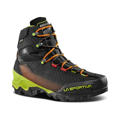
Stiff-soled mountaineering boots compatible with crampons. Not trekking boots. Break them in well before the trek.

10- or 12-point steel crampons compatible with your boots

A lightweight, comfortable harness.

A lightweight, durable climbing helmet. It should provide solid protection while being well-ventilated and comfortable for extended wear during the trek.

Collapsible trekking poles for balance and support.

One locking carabiner.

A basic mountaineering ice axe (50–60 cm)

A 30–40 litre pack with attachment points for ice axe and crampons. Must fit comfortably with a hip belt.

Your hardshell jacket must include a hood for full protection from wind, rain, and snow. Waterproof and breathable, it serves as a critical outer layer, ensuring comfort and mobility in harsh conditions.

Pack a down jacket to ensure warmth in cold conditions. Its insulation traps body heat, making it ideal for high altitudes and freezing temperatures, while remaining lightweight and compressible.

Waterproof, windproof, with full-length side zips.

Softshell or stretch fabric, wind-resistant.

Merino wool or synthetic. Avoid cotton

A midlayer top is essential for insulation and must fit comfortably over your baselayers. It provides warmth while allowing for breathability, making it ideal for varying temperatures during your tour.

Bring full-finger thin gloves for dexterity and light protection during the Haute Route. They offer warmth in mild conditions while allowing precise hand movements.

Full-finger softshell gloves are essential for protection against wind and light moisture. They offer warmth, durability, and flexibility, ensuring ease of movement while handling gear in cold conditions.

Insulating beanie for early starts and hut evenings.

Brimmed hat for sun protection during the day.

Versatile protection against sun, wind, and cold.

To keep snow and debris out of boots on glacier terrain.

Bring sunglasses with high protection (grade 3 or 4) to protect your eyes from intense sunlight and glare at high altitudes, ensuring clear vision and reducing eye strain.

Bring ski goggles to protect your eyes from blizzards, strong winds, and cold. They ensure clear vision and shield your face from harsh weather conditions.

Bring a headlamp with new batteries and a minimum output of 300 lumens.

Pack three pairs of hiking socks, long ones, for added protection. They help prevent blisters and ensure your feet stay comfortable throughout your trip.

Mandatory in all Alpine huts. Silk is lightest and most comfortable.

A hydration system with at least 1 liter capacity is essential, depending on your drinking habits. Camelbacks work well but may freeze in cold conditions, so plan accordingly to stay hydrated.

A personal care bag is essential for your trip. Include a toothbrush, toothpaste, first-aid tape, Band-Aids and any personal medications or prescriptions for a safe and comfortable journey.

Sunscreen with SPF 50 is essential for high mountain conditions, providing superior protection against harmful UV rays. Apply generously to all exposed skin to prevent sunburn during the tour.

A high-protection lipscreen is essential for shielding your lips from UV rays and harsh weather in the mountains. It helps prevent chapping and sunburn, keeping your lips moisturized and safe.

Earplugs are a must-have for your trip, especially if you find yourself in a hut with a neighbor who thinks they're auditioning for a snoring competition. Enjoy some peace and quiet!

Keep your personal documents in a waterproof bag to protect them from moisture and damage. This ensures that essentials like your ID, permits, and insurance information stay safe.
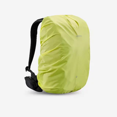
Lightweight, fitted to your pack size. Essential for keeping gear dry on rainy days.


